A Quick Check On Storms Approaching The State
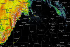
As of 8:04 am, we have another line of rain and thunderstorms moving through the eastern parts of Mississippi and is just starting to enter the extreme northwestern corner of North Alabama.

As of 8:04 am, we have another line of rain and thunderstorms moving through the eastern parts of Mississippi and is just starting to enter the extreme northwestern corner of North Alabama.

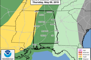
A FEW STRONG STORMS LATER TODAY: We have a few light rain showers over Northwest Alabama early this morning, but most of the state is dry with temperatures in the upper 60s and low 70s. To the west, a large mass of rain covers the broad zone from Memphis down into North Louisiana. Much of this is expected to dissipate before reaching Alabama, but additional showers and storms are expected to form this afternoon and early tonight. Where storms do form, they could be strong, and SPC has much of the state in a “marginal risk” (level 1/5).