Tornado On Ground Heading For Reform!
John Brown and Mike Wilhelm are monitoring the supercell approaching Reform. He reports that a life threatening tornado is moving into Reform right now. This is a tornado emergency for Reform.

John Brown and Mike Wilhelm are monitoring the supercell approaching Reform. He reports that a life threatening tornado is moving into Reform right now. This is a tornado emergency for Reform.

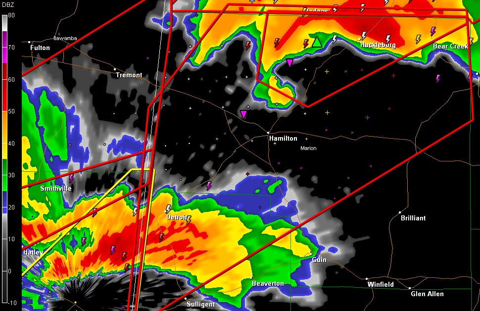
Tornadic storm over or just southeast of Hamilton… This will pass a little south of the earlier track…probably passing south of Hackleburg and then near Bear Creek and Haleyville…so heads up Winston County. NOAA Weatheradio is not working out of Winfield….

Two tornado situations in West Alabama. One is passing northwest of Tuscaloosa County. Another will affect the city more directly in about 45 minutes TORNADO WARNING NATIONAL WEATHER SERVICE BIRMINGHAM AL 338 PM CDT WED APR 27 2011 THE NATIONAL WEATHER SERVICE IN BIRMINGHAM HAS ISSUED A * TORNADO WARNING FOR… NORTHERN GREENE COUNTY IN […]

We have numerous reports of extensive damage from Cullman…including the Courthouse and EMS…perhaps the Fire Department…and possibly the Medical Center… More as the information becomes available. This storm is in northern Marshall County…north of Guntersville…will move toward Scottsboro.

At 3:38 PM Emergency Manager reports tornado on the ground has moved through downtown Hackleburg and is now north of 345. This is the same storm that moved through Hamilton earlier. It will move through Franklin County and be near Phil Campbell.

Dangerous storm passing over state line near Memphis. It will pass between Pickensville and Aliceville. Then it will pass near Carrollton… Then our friends in Reform and Gordo will be under the gun as it crosses US-82. The storm will stay northwest of the cities of Tuscaloosa and Northport.

Very strong indication of a tornado passing north of Sulligent…will pass south of Detroit…when it passes into Marion County…it could pass near Guin. The airmass is unstable…this is a volatile dangerous situation…please take these storms seriously!

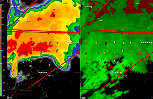
Tornado has passed near downtown Hamilton… A debris ball is evident on Doppler radar. If you are between Hamilton and Hackleburg…you need to be in a safe place NOW! Not in mobile home…not in a car… HEADS UP Another tornado may be forming in Lamar County. It is west of Sulligent. It will move northeast […]

TORNADO WARNING NATIONAL WEATHER SERVICE BIRMINGHAM AL 321 PM CDT WED APR 27 2011 THE NATIONAL WEATHER SERVICE IN BIRMINGHAM HAS ISSUED A * TORNADO WARNING FOR… NORTHERN LAMAR COUNTY IN WEST CENTRAL ALABAMA… MARION COUNTY IN NORTHWEST ALABAMA… * UNTIL 415 PM CDT * AT 319 PM CDT…THE NATIONAL WEATHER SERVICE INDICATED A SEVERE […]

From the NWS Memphis… Severe event has entered a critical phase over northeast MS, with numerous tornadoes likely on the ground at once. We are requesting spotters take measures to protect your saftey. We appreciate the reports, but only after you are out of harm’s way.

Tornado has passed near downtown Hamilton… If you are between Hamilton and Hackleburg…you need to be in a safe place NOW! Not in mobile home…not in a car… TORNADO WARNING NATIONAL WEATHER SERVICE BIRMINGHAM AL 315 PM CDT WED APR 27 2011 THE NATIONAL WEATHER SERVICE IN BIRMINGHAM HAS ISSUED A * TORNADO WARNING FOR… […]

If you are in Hamilton…especially west and north of Hamilton…you need to be in safe shelter NOW! Strong rotation is indicated! Hacklebrug will be affected as the strom moves up highway 43/17.

Tornado on the ground near Baileyton! Did tremendous damage in Cullman! Moving toward Arab! Be in safe shelter now!

Tornado near Macon MS… Will move into Pickens County… It will move near Aliceville, Carrollton, Gordo and Reform… Be in safe shelter now!