
Large Tornado On Ground Moving into Tuscaloosa
This is the tornado approaching Tuscaloosa…
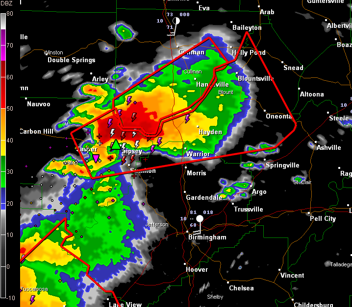
This is a very dangerous storm that is producing a large wedge tornado! TORNADO WARNING NATIONAL WEATHER SERVICE BIRMINGHAM AL 455 PM CDT WED APR 27 2011 THE NATIONAL WEATHER SERVICE IN BIRMINGHAM HAS ISSUED A * TORNADO WARNING FOR… BLOUNT COUNTY IN CENTRAL ALABAMA… NORTH CENTRAL JEFFERSON COUNTY IN CENTRAL ALABAMA… EAST CENTRAL WALKER […]

TORNADO WARNING NATIONAL WEATHER SERVICE BIRMINGHAM AL 450 PM CDT WED APR 27 2011 THE NATIONAL WEATHER SERVICE IN BIRMINGHAM HAS ISSUED A * TORNADO WARNING FOR… SOUTHERN GREENE COUNTY IN WEST CENTRAL ALABAMA… SOUTHWESTERN HALE COUNTY IN WEST CENTRAL ALABAMA… SUMTER COUNTY IN WEST CENTRAL ALABAMA… * UNTIL 545 PM CDT * AT 447 […]
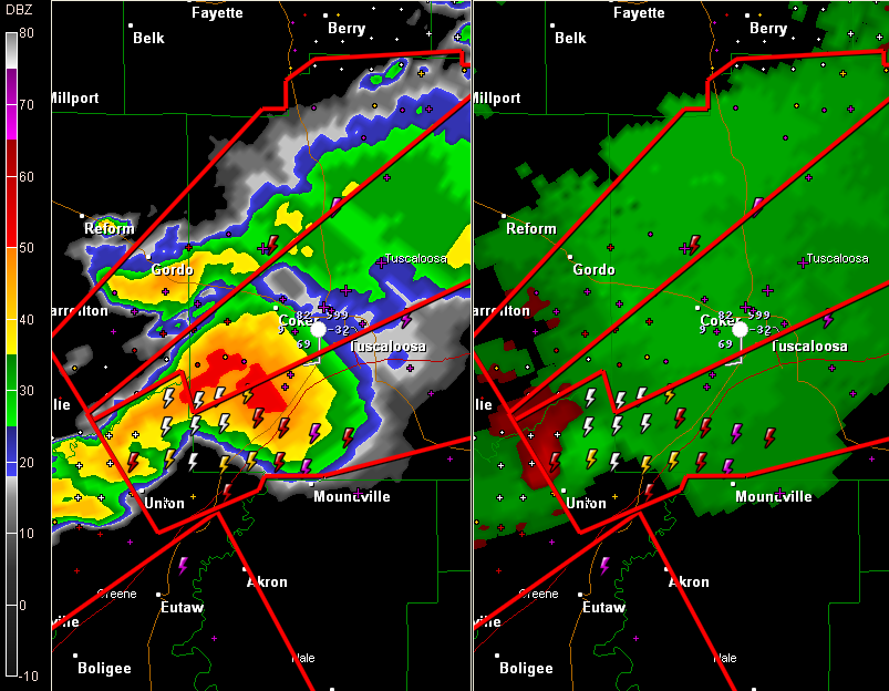
John Oldshue is tracking a large wedge tornado southwest of Tuscaloosa. This is a TORNADO EMERGENCY for a large, dangerous tornado that is approaching Tuscaloosa. Be in safe place now in Tuscaloosa, Northport and the University of Alabama campus! TORNADO WARNING NATIONAL WEATHER SERVICE BIRMINGHAM AL 447 PM CDT WED APR 27 2011 THE NATIONAL […]
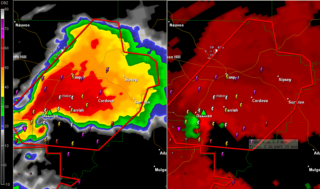
Lots of damage reports coming in from Walker County EMA now… Brian Peters sees the tornado from near Exit 72 (Cordova) on I-22… He sees two tornadoes…one is still on the ground…the other has lifted… Debris is evident! We cannot stress how serious this situation is for Cordova!
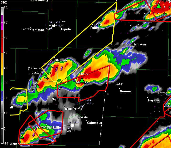
Two more tornadic storms in eastern Mississippi will impact West Alabama in the next hour… …one is near Aberdeen…it will affect Lamar County…passing near or just north of Vernon… …another is near Starkville…it will pass near Columbus and West Point…and will also affect Vernon or surrounding areas as it moves into Lamar County.

A large, damaging tornado is moving into Walker County near Oakman now… This storm will move near Parrish and then will move near the city of Jasper. Take cover now! And tell friends/neighbors!

TORNADO WARNING NATIONAL WEATHER SERVICE BIRMINGHAM AL 431 PM CDT WED APR 27 2011 THE NATIONAL WEATHER SERVICE IN BIRMINGHAM HAS ISSUED A * TORNADO WARNING FOR… EAST CENTRAL PICKENS COUNTY IN WEST CENTRAL ALABAMA… NORTHERN TUSCALOOSA COUNTY IN WEST CENTRAL ALABAMA… * UNTIL 530 PM CDT * AT 428 PM CDT…THE NATIONAL WEATHER SERVICE […]
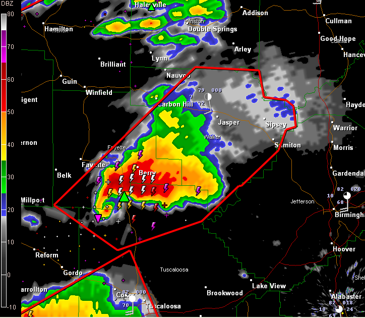
We have a potentially violent tornado doing damage in northwestern Tuscaloosa County. He shows a debris ball. It will pass near or just south of Berry. Next up will be Jasper in Walker County. Please be in a safe place now in northwestern Tuscaloosa, southeastern Berry and Walker County. This is a tornado emergency for […]

This is a dangerous storm northeast of Reform. It has a history or producing a large tornado on the ground. It will clip northwestern Tuscaloosa County…passing near New Lexington, Samantha or Moore’s Bridge..it will then move into Fayette County…passing near Berry…. It will move into Walker County…passing near Parrish, Cordova and eventually Jasper… BMX issues […]

I don’t know that I have ever seen a radar like this one… Multiple tornadic supercell thunderstorms all capable of producing strong to violent tornadoes…. Here is the radar at 4 p.m. Here are JUST the tornado warnings…

TORNADO WARNING NATIONAL WEATHER SERVICE HUNTSVILLE AL 359 PM CDT WED APR 27 2011 THE NATIONAL WEATHER SERVICE IN HUNTSVILLE HAS ISSUED A * TORNADO WARNING FOR… NORTHEASTERN CULLMAN COUNTY IN NORTH CENTRAL ALABAMA… SOUTHEASTERN MORGAN COUNTY IN NORTH CENTRAL ALABAMA… WEST CENTRAL MARSHALL COUNTY IN NORTHEAST ALABAMA… * UNTIL 430 PM CDT * AT […]

Our friend Alan Gerard at the NWS Jackson relays a report of a large tornado on the ground in Kemper County MS… This is following on the heels of the storm now moving through Sumter into northern Greene County. Both of these storms will threaten the city of Tuscaloosa.

This is a large tornado that is on the ground…it has a debris ball…it will cross I-22 and pass northwest and north of Hamilton… TORNADO WARNING NATIONAL WEATHER SERVICE BIRMINGHAM AL 356 PM CDT WED APR 27 2011 THE NATIONAL WEATHER SERVICE IN BIRMINGHAM HAS ISSUED A * TORNADO WARNING FOR… NORTHWESTERN MARION COUNTY IN […]