
Flash Flood Warning for Birmingham Metro: Turn Around, Don’t Drown This Morning!
Rainfall amounts are exceeding flash flood guidance in areas that normally flood around the Birmingham Metro this morning.

Rainfall amounts are exceeding flash flood guidance in areas that normally flood around the Birmingham Metro this morning.

Storm total rainfalls in excess of four inches have fallen from eastern Lauderdale through extreme eastern Colbert into Lawrence, western Morgan, northeastern Winston, and Cullman Counties as evidenced by the graphic on the right.

Be careful if you’re heading out this morning. Be alert for water on roadways, and always remember, Turn Around, Don’t Drown.

As of 12:34am, radar is looking better than what we were seeing at 10pm, as the rain activity has lessened in intensity. However, locations that have already seen plenty of rain today, continue to see rain at this time. There is only one active Flash Flood Warning, and that is for parts of Bibb, Chilton, Perry, and Dallas Counties.

The EMA director for Blount County. David Horton, stated that, “Some of these trees are showing signs of a possible tornado. First responders on scene are stating a few of these trees in the Locust Fork/Cleveland area are twisted.”
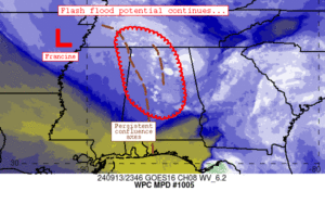
In this update, we look at the situation in parts of North Central Alabama and review the latest discussion from the WPC on how much longer we will be dealing with heavy rain!
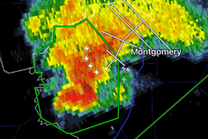
Radar now estimating 2-4 inches of rain has fallen from this nearly stationary storm.
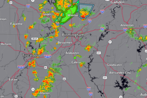
We are finishing off our week here in Alabama on a very active note. Have several flash flood warnings and flood advisories that continues across parts of the northern and central parts of the state. Some of these storms are producing rainfall rates of 1-3″+ per hour and this is on top of a few inches already bring the risk of flooding. In addition, some of the storms are packing a punch with strong winds to 40-50 mph and small hail.
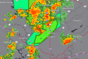
640pm Update: It continues to be a very active go of it across portions of Northern and Central Alabama with storms dumping a lot of rain in a short amount of time. The latest Flash Flood Warning gets into SW Blount and North Central Jefferson County were an estimated 2-3″+ of rain has fallen.
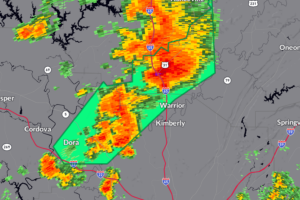
Between 1-2″ of rain has fallen, another 1-2″ could start to bring in some problems with minor flooding.
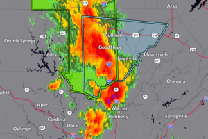
Storm packing a punch over Cullman County. It is moving northeast along around 25 mph. This is a part of the training line of storms that is also bringing the potential for isolated flooding.

This warning includes parts of I-65, Decatur and Cullman. Please be weather aware as you are heading out this Friday evening.

The heavier storms are moving more into Morgan and Cullman Counties but still some residual flooding in place for parts of Colbert, Franklin and Lawrence Counties.

The axis of very heavy rain has shifted from Upshaw to Addison over to Moreland to Houston and Arley.
 Our long time friend, mentor, and charter Weather Factory member, J.B. Elliott, passed away on May 11, 2015. Click HERE to read James' tribute.


