Alabama 811 | Know What's Below.

Category: Severe Weather

Storms Weakening Over North Alabama; But More Storms Overnight and Strong to Severe Storms Tomorrow Afternoon

Storms Weakening Over North Alabama; But More Storms Overnight and Strong to Severe Storms Tomorrow Afternoon

| September 24, 2024 @ 5:59 pm

Storms have weakened across North and West Central Alabama, but activity is expected to pick back up overnight and into tomorrow afternoon, with strong storms possible southeast of I-59.

Read More

Severe Thunderstorm Warning for Wind and Hail for Parts of Marion and Lamar Counties Until 5 pm

Severe Thunderstorm Warning for Wind and Hail for Parts of Marion and Lamar Counties Until 5 pm

| September 24, 2024 @ 4:13 pm

At 408 PM CDT, a severe thunderstorm was located near Detroit, or 12 miles west of Hamilton, moving east at 35 mph.

Read More

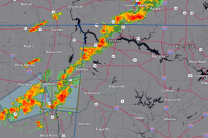
350pm CDT Radar Update:  Strong to Isolated Severe Storms From Florence, AL to Smithville, MS

350pm CDT Radar Update: Strong to Isolated Severe Storms From Florence, AL to Smithville, MS

| September 24, 2024 @ 3:53 pm

Monitoring closely the storms firing in Northwest Alabama and eastern Mississippi. They continue to move over the same areas and we may begin to see isolated flooding start to form.  There is a severe storm at Smithville, MS. 

Read More

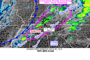
235pm CDT Radar Update and WPC Mesoscale Precipitation Discussion.

235pm CDT Radar Update and WPC Mesoscale Precipitation Discussion.

| September 24, 2024 @ 2:35 pm

Scattered thunderstorms are starting to pop along a cold front.  There is a marginal risk of severe storms across parts of Northern Alabama, with the main risk damaging wind gusts.  In addition, we have chances for very heavy rain that could lead to isolated flooding.

Read More

Isolated Severe Thunderstorm Threat Today for Parts of Northern Alabama

Isolated Severe Thunderstorm Threat Today for Parts of Northern Alabama

| September 24, 2024 @ 9:28 am

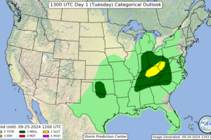
The Storm Prediction Center has placed parts of Northern Alabama under a marginal risk (level 1 out of 5) of severe thunderstorms today.  This activity would form along a slow-moving cold front. 

Read More

Storm Surge and Tropical Storm Watches Issued for Parts of Southwest Florida

Storm Surge and Tropical Storm Watches Issued for Parts of Southwest Florida

| September 23, 2024 @ 9:50 pm

As of 11 PM EDT, the system is located about 100 miles southwest of Grand Cayman and is moving north-northwest at 6 mph with maximum winds of 35 mph and a central pressure of 1002 MB.

Read More

Models Are Starting to Become A Little Closer in Agreement on the Tropical Weather Threat for the Gulf of Mexico

Models Are Starting to Become A Little Closer in Agreement on the Tropical Weather Threat for the Gulf of Mexico

| September 21, 2024 @ 4:54 pm

The latest European ensemble members model run is out, and there is a 60% chance that a tropical storm will develop over the Gulf of Mexico.

Read More

Model Madness As We Wait for Tropical Development Over the Gulf of Mexico

Model Madness As We Wait for Tropical Development Over the Gulf of Mexico

| September 21, 2024 @ 10:51 am

As we continue to hear about the potential for a tropical system developing over the Gulf of Mexico next week, the models are all over the place in strength, directions, and landfall locations.

Read More

Drought Monitor: Francine Brought Some Improvements; Most of Alabama Still Highlighted Though with Abnormally Dry/Drought Conditions

Drought Monitor: Francine Brought Some Improvements; Most of Alabama Still Highlighted Though with Abnormally Dry/Drought Conditions

| September 19, 2024 @ 5:30 pm

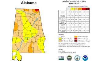
The U.S Drought Monitor has issued their latest update.  Tropical moisture from Hurricane Francine did help a bit in some areas with the drought conditions. One to locally two-category drought reductions occurred especially where extreme rainfall was seen.  Sadly, some areas saw such extreme rain it led to massive flooding.  Here is this week’s snapshot: […]

Read More

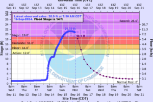
Flood Warning for Big Nance Creek at Courtland Extended. Major flooding occurring.

Flood Warning for Big Nance Creek at Courtland Extended. Major flooding occurring.

| September 16, 2024 @ 9:07 am

The stage this morning was 20.8 feet with the maximum stage over the past 24 hours at 21.3 feet. 

Read More

Fewer Showers, Warmer/Drier Days Ahead for Alabama; but Eyes on the Tropics

Fewer Showers, Warmer/Drier Days Ahead for Alabama; but Eyes on the Tropics

| September 15, 2024 @ 2:41 pm

While Alabama sees fewer showers and a warming trend this week, attention shifts to Invest 95L off the South Carolina coast, with models indicating possible tropical development in the next 18-24 hours.

Read More

Crest Forecast Increased at Courtland…Highest Level Since 1965

Crest Forecast Increased at Courtland…Highest Level Since 1965

| September 15, 2024 @ 1:38 pm

The flood warning for Big Nance Creek at Courtland has been extended with the crest forecast increased to 21.5 feet, worsening the flood impact and making several streets impassable.

Read More

Flash Flood Watches Have Expired…Rain Shifting West, Coverage Will Be Less Today

Flash Flood Watches Have Expired…Rain Shifting West, Coverage Will Be Less Today

| September 15, 2024 @ 7:20 am

The flash flood threat has lessened enough for flash flood watches to expire. There will be showers today that will produce heavy rain in spots, but they will be fewer and farther between.

Read More

Additional Flash Flooding Concerns for Northwest/North Central Alabama…and Serious Flash Flooding Ongoing in Houston/Henry Counties in Southeast Alabama

Additional Flash Flooding Concerns for Northwest/North Central Alabama…and Serious Flash Flooding Ongoing in Houston/Henry Counties in Southeast Alabama

| September 15, 2024 @ 12:22 am

The WPC has issued two mesoscale precipitation discussions recently for Alabama.

Read More