
Alabama Legacy Moment: Fort Morgan
The fort was last activated during World War II.
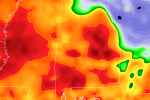
Severe thunderstorms with damaging winds up to 60-70 MPH continue to push through the northeastern quarter of the state and has now entered into the Central Alabama counties.
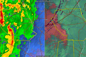
UPDATE 330 PM The warning for Lee County has expired. The storms moved into Georgia. …A SEVERE THUNDERSTORM WARNING REMAINS IN EFFECT UNTIL 330 PM CST FOR NORTHEASTERN LEE COUNTY… At 316 PM CST, severe thunderstorms were located along a line extending from near Beulah to near Cusseta, moving east at 40 mph. HAZARD…60 […]
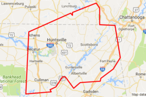
The National Weather Service in Huntsville Alabama has issued a * Flood Warning for… Jackson County in northeastern Alabama… Marshall County in northeastern Alabama… Madison County in north central Alabama… Limestone County in north central Alabama… DeKalb County in northeastern Alabama… Cullman County in north central Alabama… Morgan County in north central Alabama… Southeastern Lincoln […]
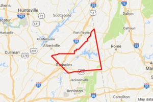
Heavy rain continues across North Alabama on the north side of the upper low, which is moving across South Central Alabama. With the recent drought, it’s hard to imagine that we could be worried about flooding, but the steady rain all afternoon and last night are causing some problems. The rain over Northwest Alabama should […]
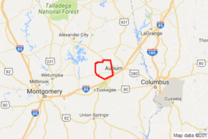
…A TORNADO WARNING REMAINS IN EFFECT UNTIL 915 AM CST FOR NORTHWESTERN LEE COUNTY… At 905 AM CST, a severe squall line capable of producing both tornadoes and extensive straight line wind damage was located along a line extending from 6 miles northeast of Jacksons’ Gap to near Auburn, moving east at 30 mph. HAZARD…Tornado. […]

The National Weather Service in Huntsville has issued an Areal Flood Warning for: Southeastern Colbert County in northwestern Alabama… Eastern Franklin County in northwestern Alabama… Lawrence County in northwestern Alabama… * Until 945 PM CST * At 653 PM CST, Doppler radar indicated a slow moving band of moderate to heavy rain imapcting the warning […]

The National Weather Service in Huntsville has issued an Areal Flood Warning for: Limestone County in north central Alabama… Cullman County in north central Alabama… Morgan County in north central Alabama… * Until 830 PM CST * At 534 PM CST, reports from emergency managers, trained weather spotters, and the general public confirmed flooding occurring […]

The severe threat is starting to come to an end for most of Central Alabama at this time. The main focus for the next hour will be on the southeastern counties of the area, especially Lee, Tallapoosa, and Chambers counties. A Severe Thunderstorm Warning remains in effect for those counties until 2:45 PM. Damage reports […]

…A TORNADO WARNING REMAINS IN EFFECT UNTIL 215 PM CST FOR NORTHWESTERN LEE COUNTY… At 154 PM CST, a severe thunderstorm capable of producing a tornado was located over Auburn, moving northeast at 25 mph. HAZARD…Tornado. SOURCE…Radar indicated rotation. IMPACT…Flying debris will be dangerous to those caught without shelter. Mobile homes will be damaged or […]

The National Weather Service has removed Elmore, Montgomery, and Pike counties from the PDS Tornado Watch. The PDS Tornado Watch continues for Barbour, Bullock, Chambers, Coosa, Lee, Macon, Russell, and Tallapoosa counties until 7:00 PM CST.

At 228 PM CST, severe thunderstorms were located along a line extending from 7 miles southwest of Franklin to near Hamilton to near Upatoi, moving east at 65 mph. HAZARD…60 mph wind gusts and quarter size hail. SOURCE…Radar indicated. IMPACT…Hail damage to vehicles is expected. Expect wind damage to roofs, siding, and trees. Locations impacted […]

…THE TORNADO WARNING FOR NORTHERN AUTAUGA COUNTY IS CANCELLED… The tornado threat has diminished and the Tornado Warning has been cancelled. However, large hail and damaging winds remain likely and a Severe Thunderstorm Warning remains in effect for the area. A tornado watch remains in effect until 700 PM CST for east central Alabama. The […]

The National Weather Service has removed Autauga, Chilton, and Lowndes counties from the PDS Tornado Watch. The PDS Tornado Watch continues for Barbour, Bullock, Chambers, Coosa, Elmore, Lee, Macon, Montgomery, Pike, Russell, and Tallapoosa counties until 7:00 PM CST.
Notifications