The Great Appalachian Storm of 1950
Forecasts for Thanksgiving Day, November 23, 1950, had warned of an approaching cold wave from the Ohio Valley into the Deep South, but weathermen were caught unaware by the explosive deepening of the weather system they were monitoring. Rain changed to snow late on Thanksgiving Day and continued through much of Friday the 24th across Ohio as a low pressure system developed over Virginia and North Carolina.
On the morning of November 25, 1950, weather maps showed a rapidly deepening low pressure system over southern Virginia. The low was drawing its strength from a powerful upper level low to the west. Snow was intensifying over a wide area. Before it was over, a widespread area of 20-30 inch snowfalls blanketed eastern Ohio, West Virginia and western Pennsylvania. 44 inches was measured at Steubenville, Ohio, an all time record for the Buckeye State. 30 inches fell at Pittsburgh.
Meanwhile, barometers under intense high pressure over eastern Canada read 1049 millibars or near 31 inches! This high was going nowhere, blocking the low from moving northeast. The pressure gradient between the 991 mb low (29.26 inches) and the high was producing very strong winds of 40 to 60 mph and resulting in blizzard conditions over a wide area. It was the worst blizzard on record at Dayton, Ohio. Winds gusted to 108 mph at Newark, New Jersey and 94 mph in New York City. Coastal flooding inundated the runways at LaGuardia Airport.
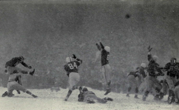
At Columbus, Ohio, preparations were underway at The Horseshoe for the game of the college football year between Ohio State and Michigan. Temperatures were in the single digits with a howling north wind. The Athletic Directors decided to play the game despite the fact that roads were blocked by snowdrifts over nearly the entire state. The Rose Bowl berth was on the line! The tarps were frozen to the field and visibility was so limited by heavy snow throughout the game that it was nearly impossible to see the players from the press box.
Still, over 50,000 people showed up for the Snow Bowl, which saw only 27 yards of offense from the victorious Michigan Wolverines, who did not make a single first down! 9 inches of snow would be on the ground by early evening. Finding the yard markers and even the players sometimes was a chore. The poor field conditions resulted in 45 punts during the game.
Record cold exacerbated the problem and many all time November records were established, including the reading of 5F at Birmingham as well as 3F at Atlanta and 22F in Pensacola. Crop losses were significant. Birmingham picked up an inch of snow.
The Thanksgiving Weekend Storm, or Great Appalachian Storm of 1950 would go on to become the costliest storm up to that point according to the insurance industry, surpassing all previous hurricanes and tornadoes.
Category: Met 101/Weather History


