

Sun, Heat, Scattered Storms Through The Weekend
RADAR CHECK: Scattered showers and a few thunderstorms are mainly over West and South Alabama this afternoon, otherwise the sky is partly sunny with temperatures mostly in the 88-94 degree range. Showers will end this evening, and tonight will be mostly fair with a low in the 70s.
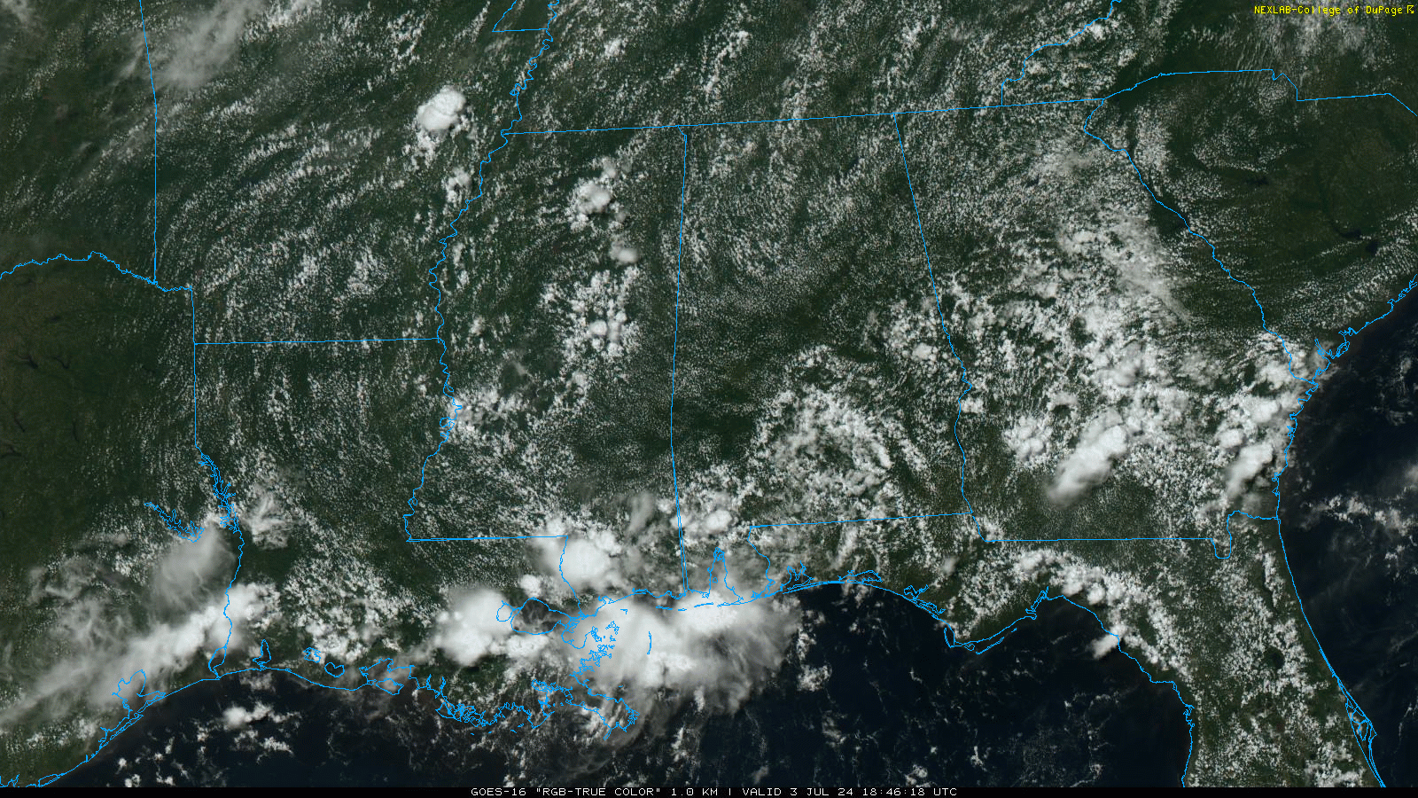
A few scattered showers and storms are possible tomorrow, but coverage of afternoon showers and storms will increase Friday and Saturday; the chance of a specific location seeing rain tomorrow is 20-30 percent, and 50-60 percent Friday and Saturday. Most, but not necessarily all of the showers and storms will come from about 1:00 until 10:00 p.m. Models suggest showers will become fewer in number by Sunday.
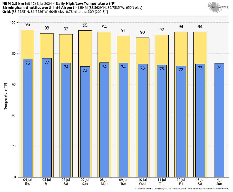
NEXT WEEK: We will broad brush the forecast with routine summer conditions next week. Partly sunny, hot, humid days with “scattered, mostly afternoon and evening showers and thunderstorms”. Highs remain in the 90s, with lows in the 70s. It is that time of the year when major weather changes don’t happen often unless a tropical system is involved. See the video briefing for maps, graphics, and more details.
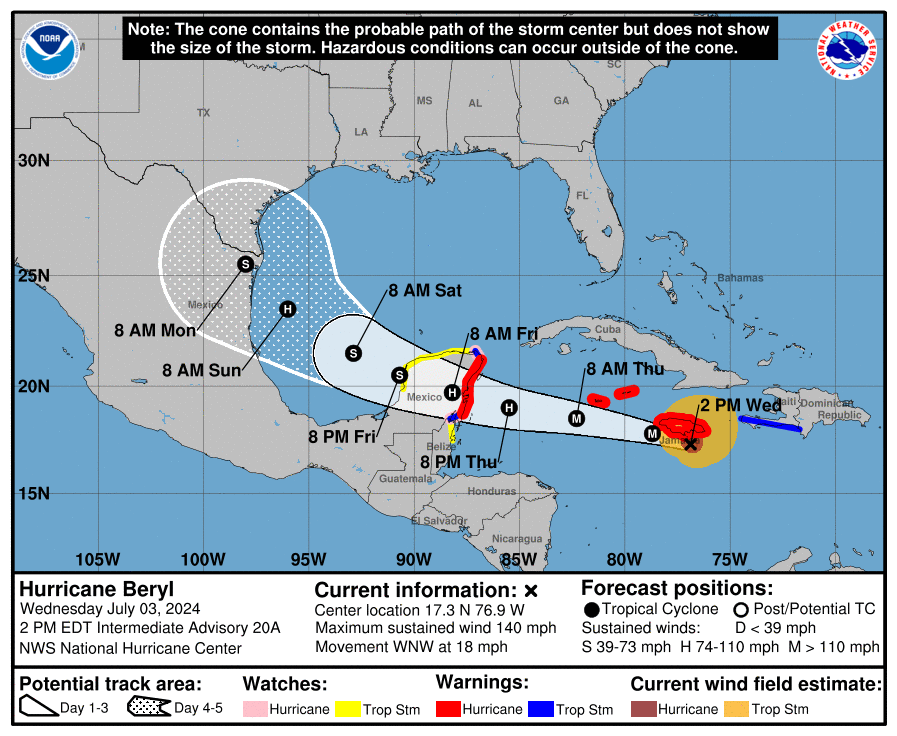
TROPICS: Hurricane Beryl, with sustained winds of 140 mph, is about 45 miles south of Kingston, Jamaica this afternoon in the Caribbean. Devastating hurricane-force winds, life-threatening storm surge, and damaging waves are expected to begin in Jamaica within the next few hours and spread into the Cayman Islands tonight. Mountainous locations in Jamaica are likely to experience destructive wind gusts.
Damaging winds, a dangerous storm surge, and heavy rainfall are expected over portions of the Yucatan Peninsula and Belize beginning tomorrow night as Beryl approaches that area as a hurricane. Hurricane and Tropical Storm Warnings are now in effect for portions of that area.
Beryl will emerge into the Southwest Gulf of Mexico as a tropical storm; NHC forecasts the final landfall at a point just south of Brownsville, Texas Sunday night as a category one hurricane.
There will be no weather impact for the Central Gulf Coast (Gulf Shores to Panama City Beach), but the risk of rip currents there will be high by Saturday and Sunday.
We also note there is a tropical wave (Invest 96L) trailing Beryl, approaching the Windward Islands. At this point the chance of development is only 20 percent over the next seven days thanks to dry air around the system, and upwelling from Beryl.
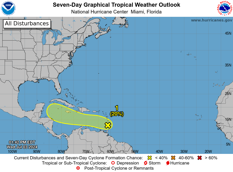
The rest of the Atlantic basin is quiet.
ON THIS DATE IN 1975: Up to 3 inches of rain caused flash flooding throughout Las Vegas, NV. The main damage occurred to vehicles at Caesars Palace with approximately 700 damaged or destroyed with several cars found miles away. North Las Vegas was hardest hit with $3.5 million in damage. Two people drowned in the flood waters.
Look for the next video briefing here by 6:00 a.m. tomorrow…
Category: Alabama's Weather, ALL POSTS, Weather Xtreme Videos
About the Author (Author Profile)
James Spann is one of the most recognized and trusted television meteorologists in the industry. He holds the AMS CCM designation and television seals from the AMS and NWA. He is a past winner of the Broadcast Meteorologist of the Year from both professional organizations.Subscribe
If you enjoyed this article, subscribe to receive more just like it.


