

Scattered Storms Around Through The Weekend
RADAR CHECK: Scattered showers and thunderstorms continue across Alabama this afternoon. The key word is scattered; not raining everywhere, but some places are getting a good summer soaker. The showers are rotating around a broad upper low that formed over the state; they will diminish after dark. Temperatures are only in the 80s in most communities; a nice break from the heat in recent days.
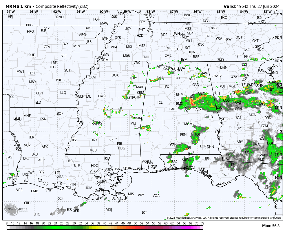
Showers will likely be a little fewer in number across the state tomorrow; the chance of any one spot getting wet is 25-35 percent with a high in the low 90s.
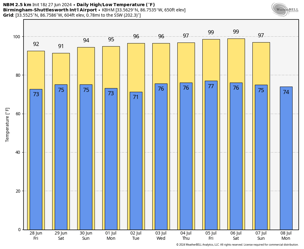
THE ALABAMA WEEKEND: Pretty routine summer weather for the weekend. Partly sunny days with “scattered, mostly afternoon and evening showers and thunderstorms” around. Chance of any specific location seeing rain both days is 50-60 percent, and most (but not necessarily all) of the showers will come from about 1:00 until 10:00 p.m. The high Saturday will be in the low 90s, followed by mid 90s Sunday.
NEXT WEEK: Drier air moves into the state early in the week; we expect mostly sunny hot days and fair nights Monday and Tuesday with only a small risk of a shower each day. Highs will rise into the mid to upper 90s. A pop-up afternoon storm is a bit more likely over the latter half of the week, but even then widespread rain isn’t especially likely. See the video briefing for maps, graphics, and more details.
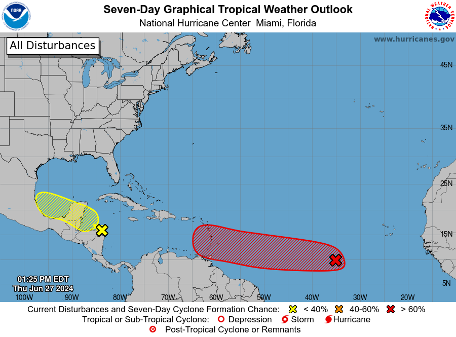
TROPICS: A broad area of low pressure over the western Caribbean Sea is producing widespread but disorganized shower and thunderstorm activity while it moves west-northwestward at around 15 mph. Some development of this system is possible over the northwestern Caribbean Sea or over the southwestern Gulf of Mexico during the next few days. NHC gives it only a 20 percent chance of development for now; if anything happens to form it will move into Mexico.
Of more interest is Invest 95L in the Central Atlantic. This tropical wave located several hundred miles west-southwest of the Cabo Verde Islands, and continues to produce disorganized shower and thunderstorm activity. Environmental conditions are forecast to be conducive, and development of this system is anticipated. A tropical depression or tropical storm is likely to form this weekend several hundred miles east of the Windward Islands while the system moves westward at 15 to 20 mph. Interests in the Lesser Antilles should monitor the progress of this system. NHC gives it an 80 percent chance of development.
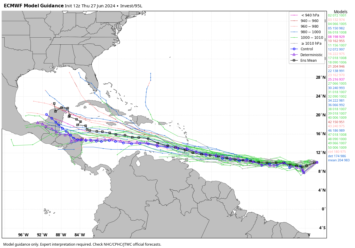
The reliable European global model (ensemble output) suggests this system will keep moving generally westward, toward either Central America or Mexico, but it is simply too early to know the ultimate destination; it all depends on how the upper air pattern evolves in 7-10 days. No tropical storms or hurricanes for the Central Gulf Coast (Gulf Shores to Panama City Beach) through next week.
ON THIS DATE IN 1957: Hurricane Audrey made landfall Sabine Pass and Johnsons Bayou, Louisiana. Hurricane Audrey ranks as the 7th deadliest hurricane to strike the United States (3rd deadliest within Louisiana) in modern record keeping, with at least 500 deaths. The exact number will never be known, as many perished in the storm surge in Cameron and Vermilion parishes, and many missing persons were never found.
Along with Hurricane Alex in 2010, it was also the strongest June hurricane ever recorded in the Atlantic basin as measured by pressure. The rapidly developing storm struck southwestern Louisiana as an intense Category 3 hurricane, destroying coastal communities with a powerful storm surge that penetrated as far as 20 miles inland.
Look for the next video briefing here by 6:00 a.m. tomorrow…
Category: Alabama's Weather, ALL POSTS, Weather Xtreme Videos
About the Author (Author Profile)
James Spann is one of the most recognized and trusted television meteorologists in the industry. He holds the AMS CCM designation and television seals from the AMS and NWA. He is a past winner of the Broadcast Meteorologist of the Year from both professional organizations.Subscribe
If you enjoyed this article, subscribe to receive more just like it.


