

Hot Weekend Weather; Invest 92L Trying to Become a Depression
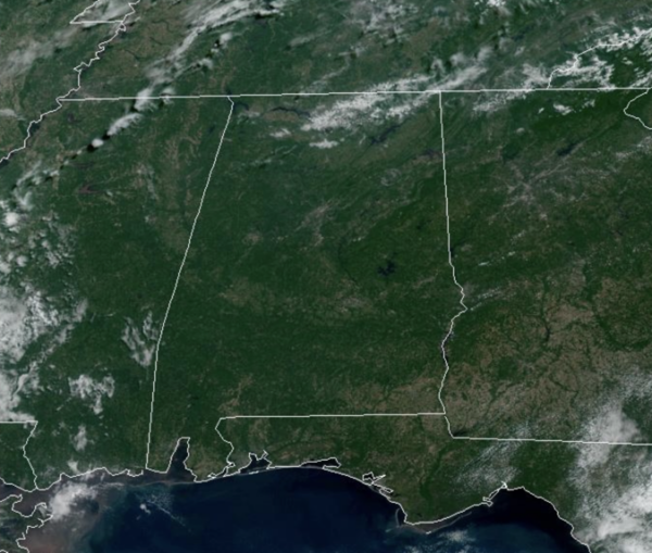
HOT ALABAMA WEATHER: Plenty of sunshine and hot weather highlights the forecast today and through the upcoming weekend. Highs today are in the low to mid 90s with little chance of a passing shower. Heat levels continue to rise with highs in the mid and upper 90s tomorrow and Sunday. Moisture levels will rise both days as well, meaning those heat index values are likely to climb over 100°. A few, widely isolated afternoon showers and storms will be possible both days.
BIRMINGHAM ALMANAC: For June 21st, the average high for Birmingham is 89° and the average low is 70°. The record high is 102° set in 1933, while the record low is 57° set in 1976. We average 0.16” of precipitation on this date, and the record value is 1.99” set in 1952.
ACROSS THE USA: Widespread showers and thunderstorms in the Four Corners region and northern Plains into the Upper Midwest today may bring heavy to excessive rainfall with a potential for scattered instances of flash and urban flooding. Dangerous heat will continue to impact the Midwest and Ohio Valley today and peak in the Mid-Atlantic/I-95 Urban Corridor this weekend.
NEXT WEEK: Moisture levels continue to rise Monday through Wednesday with showers and storms increasing in number. Temperatures will remain above average with afternoon highs in the mid 90s. For the second half of next week, moisture levels remain, which means scattered showers and storms, but highs could slip down into the low 90s.
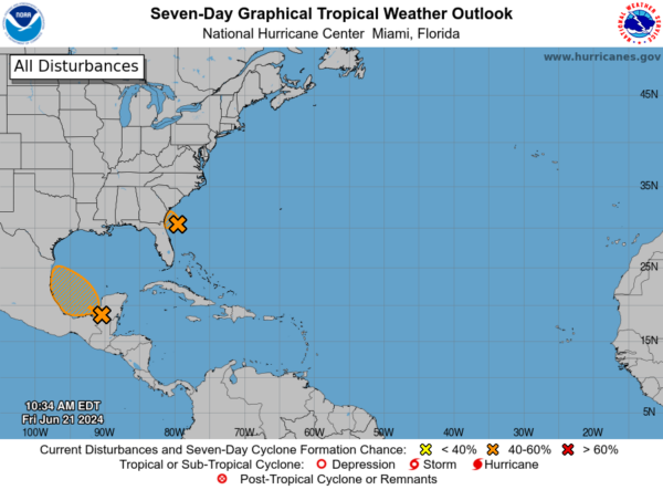
IN THE TROPICS: Two features the NHC continues to monitor.
1. Southwestern Atlantic Ocean (AL92): Updated: Recent data from an Air Force Reserve reconnaissance aircraft and visible satellite imagery indicate that the area of low pressure located about 120 miles east of Jacksonville, Florida, has developed a well-defined center of circulation and is producing winds to near 35 mph, but the associated showers and thunderstorms are not quite organized enough for this system to be considered a tropical cyclone.
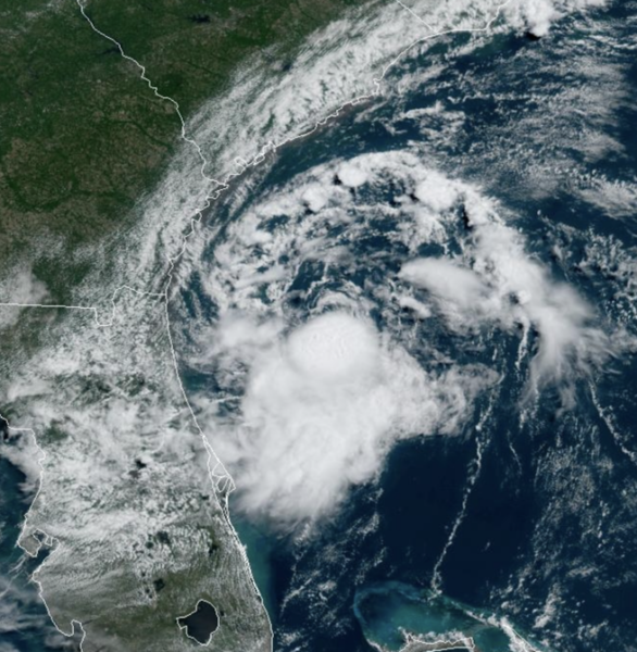
However, only a small increase in the organization of the showers and thunderstorms could result in the formation of a short-lived tropical depression before it reaches the coast of northeastern Florida or Georgia tonight, and interests there should monitor its progress. For more information, refer to High Seas Forecasts issued by the National Weather Service, as well as local forecasts issued by your local National Weather Service Forecast Office. Formation chance…medium…60 percent.
2. Southwestern Gulf of Mexico: A broad area of low pressure is forecast to form over southeastern Mexico later today. Environmental conditions appear conducive for gradual development after this system moves over the Bay of Campeche tonight, and a tropical depression could form over the southwestern Gulf of Mexico this weekend while it moves slowly west-northwestward or northwestward. Interests along the Gulf coast of Mexico should monitor the progress of this system. Formation chance through 48 hours…medium…50 percent. Formation chance through 7 days…medium…60 percent.
Next two names up are Beryl and Chris.
BEACH FORECAST CENTER: Dangerous and strong rip currents will continue for through today, but the rip current threat begins to decrease some tomorrow and into next week, but still pay attention to the flag warning system at each beach.
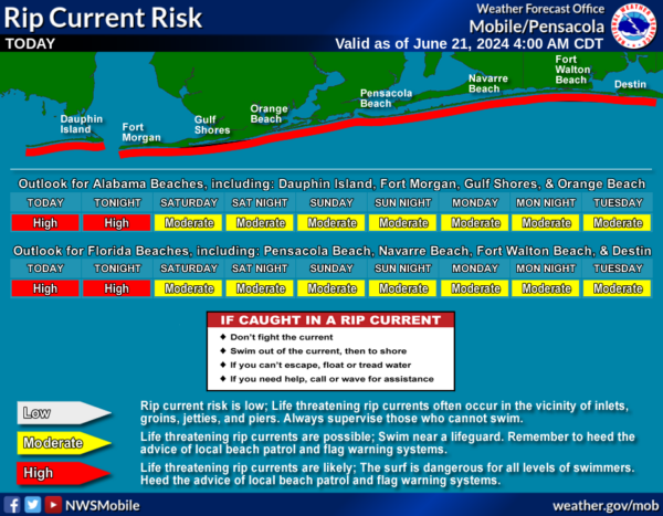
The weather at the beach will be mainly sunny and dry through the weekend with highs in the upper 80s and lower 90s. Rain chances begin to increase early next week. Water temperatures are very warm with mid-80s being reported up and down the Northern Gulf Coast. Get the latest weather and rip current forecasts for the beaches from Fort Morgan to Panama City on our Beach Forecast Center page. There, you can select the forecast of the region that you are interested in visiting.
WORLD TEMPERATURE EXTREMES: Over the last 24 hours, the highest observation outside the U.S. was 122.9F at Nasiriya, Iraq. The lowest observation was -94.7F at Concordia, Antarctica.
CONTIGUOUS TEMPERATURE EXTREMES: Over the last 24 hours, the highest observation was 115F at Phoenix, AZ. The lowest observation was 29F at Mackay, ID.
Category: Alabama's Weather, ALL POSTS
About the Author (Author Profile)
Macon, Georgia Television Chief Meteorologist, Birmingham native, and long time Contributor on AlabamaWX. Stormchaser. I did not choose Weather, it chose Me. College Football Fanatic. @Ryan_StinnetSubscribe
If you enjoyed this article, subscribe to receive more just like it.


