

Getting Hotter Through the Weekend; Rain Chances Go Up by Wednesday
Friday and The Weekend
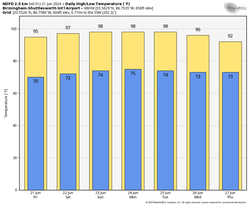
High pressure will dominate our area today, as easterly to southeasterly winds will bring higher moisture levels to the southeastern locations, potentially causing some light rain this afternoon. For the rest of Central Alabama, expect dry weather with rising temperatures. By the afternoon, temperatures will be in the mid to upper 90s, and it will feel even hotter due to the higher humidity.
By Saturday, ridging over Alabama will create weak winds and hot conditions, with temperatures reaching the mid-90s. Southeasterly winds will increase moisture levels in our southern and eastern counties, possibly leading to isolated showers and storms in the afternoons and evenings south of Interstate 20.
The ridge will shift westward on Sunday, allowing a trough to develop over the eastern U.S. This change will bring continental northwesterly winds at high altitudes and westerly winds at lower levels, making Sunday even hotter with highs in the upper 90s. The rain chances will remain low on Sunday, but these hot conditions could persist into the beginning of the work week as moisture continues to increase.
Monday Through Thursday
Increasing humidity levels will make it muggy across the area to start the work week. On Monday, it will be very hot and humid, with only a small chance of isolated to scattered showers and storms during the afternoon. Highs in the mid to upper 90s under partly sunny skies.
No change is expected in the forecast on Tuesday, as it will nearly be a carbon copy of Monday. Hot and humid with a low chance of isolated to scattered afternoon showers and storms. Highs once again in the mid to upper 90s.
By Wednesday, a significant change in our weather pattern will happen. An increase in moisture levels combined with increasing instability will lead to widespread convection. This means you can expect more frequent showers and thunderstorms across the area. The good news is that these storms will help provide some reduction in temperatures, and bringing some relief from the recent heat. Highs in the lower to mid 90s.
The weather will stay somewhat active on Thursday, as scattered showers and storms will be possible at times. While humidity levels will continue to be high with plenty of moisture in place, afternoon highs will be a little cooler, in the upper 80s to the lower 90s.
Update on the Tropics
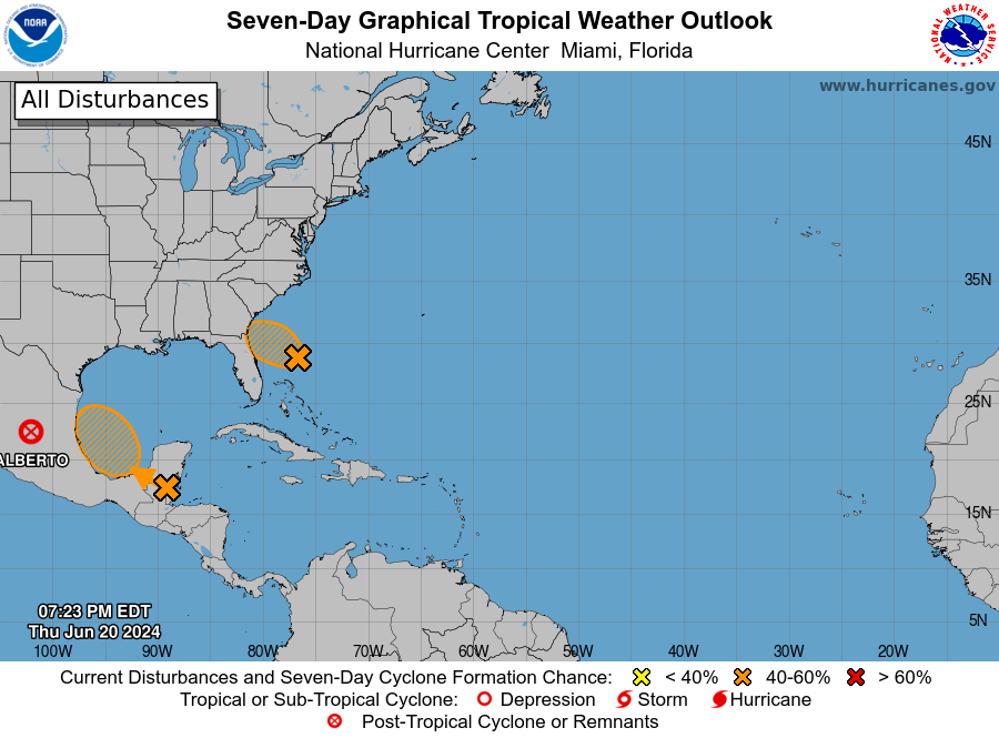
Alberto: As of Thursday at 4:00 PM CDT, the circulation of Alberto has dissipated, but heavy rains and flash flooding persist in northeastern Mexico.
Invest 92 – Southwestern Atlantic Ocean: A low-pressure area located 175 miles north-northeast of the northern Bahamas is showing better organization. It could become a tropical depression while moving west-northwestward at 10-15 mph, potentially impacting the northeastern coast of Florida or Georgia early on Friday. The chance of formation through 48 hours is 50%, and 50% through 7 days.
Southwestern Gulf of Mexico: A broad low-pressure area is expected to form over southeastern Mexico and northern Central America on Friday. Conditions are conducive for gradual development as it moves over the Bay of Campeche on Saturday, with a tropical depression possible this weekend. The chance of formation through 48 hours is 30%, and 60% through 7 days.
Category: Alabama's Weather, ALL POSTS, Tropical, Weather Xtreme Videos
About the Author (Author Profile)
Scott Martin is an operational meteorologist, professional graphic artist, musician, husband, and father. Not only is Scott a member of the National Weather Association, but he is also the Central Alabama Chapter of the NWA president. Scott is also the co-founder of Racecast Weather, which provides forecasts for many racing series across the USA. He also supplies forecasts for the BassMaster Elite Series events including the BassMaster Classic.Subscribe
If you enjoyed this article, subscribe to receive more just like it.


