

Midday Nowcast: Plenty of Sunshine and Less Humid
Greetings from the road as I am on my way to Myrtle Beach, South Carolina to attend the 51st Conference on Broadcast Meteorology and Seventh Conference on Weather Warnings and Communication. I will be attending the conference with meteorologist from all of the country in an effort to learn and be better prepared to communicate weather threats to everyone.
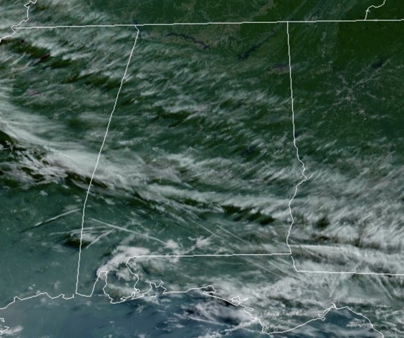
The weather today and the rest of this week will be generally dry across Alabama. Expect lower humidity but, heat levels rise by the end of the week with highs in the low to mid 90s. A few spotty showers are possible near the Gulf Coast late in the week, but nothing especially widespread is expected for now.
BIRMINGHAM ALMANAC: For June 11th, the average high for Birmingham is 88° and the average low is 68°. The record high is 98° set in 2007, while the record low is 50° set in 1988. We average 0.16” of precipitation on this date, and the record value is 1.68” set in 1952.
ACROSS THE USA: Dangerously hot temperatures will return to the southwestern U.S. and central valley of California Tuesday and Wednesday then spread across the southern & eastern U.S. the second half of this week. Heavy to excessive rainfall may bring areas of flash and urban flooding, with locally considerable urban flooding possible, at times Tuesday into this weekend over the southern Florida Peninsula.
THE ALABAMA WEEKEND: Much of North and Central Alabama will likely stay dry with only very isolated showers Saturday and Sunday; showers are more likely over the far southern part of the state and along the Gulf Coast, but the weekend won’t be a wash-out there. It should be the hottest weekend so far this year with highs in the mid 90s thanks to a heat ridge overhead. Some communities could reach the upper 90s. The pattern continues to look relatively dry for the following week with only widely scattered showers and storms around; highs will be in the low to mid 90s on most days.
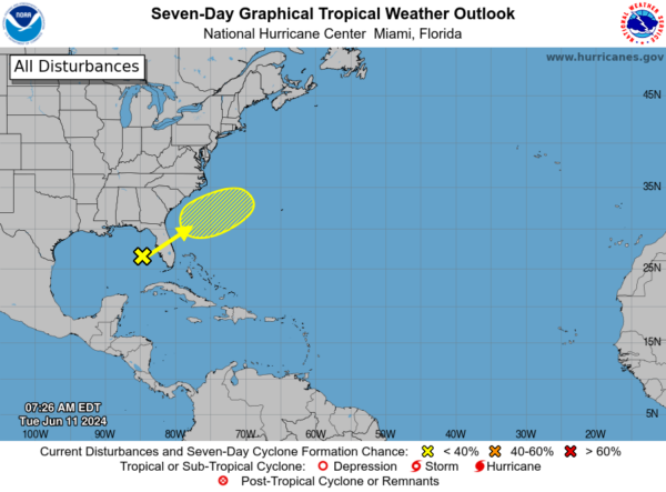
IN THE TROPICS: A trough of low pressure over the eastern Gulf of Mexico is producing a large area of disorganized showers and thunderstorms. This system is expected to move northeastward across Florida during the next day or so and offshore of the U.S. Southeast coast later this week. Environmental conditions are expected to be generally unfavorable, although some slow development is possible when the system is offshore of the U.S. Southeast coast. Regardless of development, heavy rainfall is expected across portions of Florida during the next few days. Formation chance through 7 days…low…20 percent.
BEACH FORECAST CENTER: Get the latest weather and rip current forecasts for the beaches from Fort Morgan to Panama City on our Beach Forecast Center page. There, you can select the forecast of the region that you are interested in visiting.
WORLD TEMPERATURE EXTREMES: Over the last 24 hours, the highest observation outside the U.S. was 120.2F at Al Qaysumah, Saudi Arabia. The lowest observation was -86.8F at Dome C, Antarctica.
CONTIGUOUS TEMPERATURE EXTREMES: Over the last 24 hours, the highest observation was 112F at Stovepipe Wells, CA. The lowest observation was 26F at Covington, MI.
Category: Alabama's Weather, ALL POSTS
About the Author (Author Profile)
Macon, Georgia Television Chief Meteorologist, Birmingham native, and long time Contributor on AlabamaWX. Stormchaser. I did not choose Weather, it chose Me. College Football Fanatic. @Ryan_StinnetSubscribe
If you enjoyed this article, subscribe to receive more just like it.


