

Midday Nowcast: Daily Showers and Storms through the Weekend
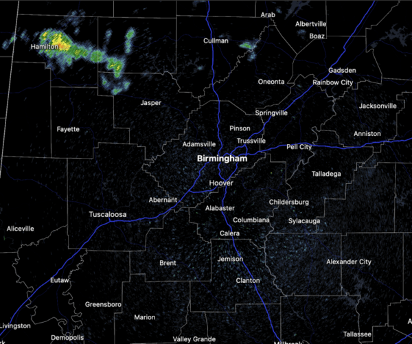
More clouds than sun across Alabama today and through the weekend. The clouds will also produce with scattered showers and some rumbles of thunder the rest of today and into tonight. Highs today are in the mid 80s. Late this morning, some showers are ongoing across our northwest counties, including Marion, Winston, and Walker counties.
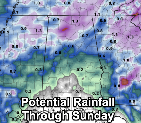
Little change in the forecast for tomorrow and Sunday as scattered showers and storms will remain in the forecast. Expect more clouds than sun this weekend, and though showers are possible at anytime, the highest coverage will come mainly during the afternoon and evening hours. It still looks as though the greatest coverage will be over the northern half of the state. The weekend certainly won’t be a wash-out, and not everyone will see rain. Some thunder is possible, but severe storms are not expected. Highs will be in the mid 80s. Rainfall totals through Sunday will vary greatly across the state, with some locations remaining dry, while some spots could receive over an inch.
BIRMINGHAM ALMANAC: For May 3rd, the average high for Birmingham is 79° and the average low is 57°. The record high is 93° set in 1902, while the record low is 40° set in 1971. We average 0.17” of precipitation on this date, and the record value is 2.46” set in 1917.
ACROSS THE USA: Heavy rainfall and flooding concerns continue for portions of Texas into the lower Mississippi Valley. Severe thunderstorms are expected to redevelop across areas of central Texas later today. Meanwhile, strong Pacific storm will move ashore this weekend. Increasing winds for many areas of the West and Southwest, heavy precipitation with snow for the higher terrain.
NEXT WEEK: Warm weather continues with highs in the 80s and perhaps low 90s. A fairly moist airmass will be in place, meaning some risk of at least scattered showers on most days, but again, nothing widespread. This is an early summer-preview for Alabama. With the main storm track well to the west and north of Alabama, we still see no sign of any high impact weather event for our state through the week (flooding, severe storms, etc).
BEACH FORECAST CENTER: Get the latest weather and rip current forecasts for the beaches from Fort Morgan to Panama City on our Beach Forecast Center page. There, you can select the forecast of the region that you are interested in visiting.
WORLD TEMPERATURE EXTREMES: Over the last 24 hours, the highest observation outside the U.S. was 118.2F at Joba, Oman. The lowest observation was -95.4F at Concordia, Antarctica.
CONTIGUOUS TEMPERATURE EXTREMES: Over the last 24 hours, the highest observation was 102F at Rio Grande Village, TX. The lowest observation was 15F at Burgess Junction, WY.
Category: Alabama's Weather, ALL POSTS
About the Author (Author Profile)
Macon, Georgia Television Chief Meteorologist, Birmingham native, and long time Contributor on AlabamaWX. Stormchaser. I did not choose Weather, it chose Me. College Football Fanatic. @Ryan_StinnetSubscribe
If you enjoyed this article, subscribe to receive more just like it.


