

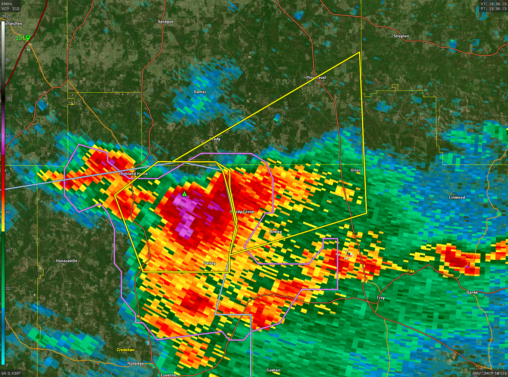
Severe Thunderstorm Warning for Pike and Montgomery Counties
A severe thunderstorm is located southwest of Shady Grove, entering northwest Pike County.
It will move into southeastern Montgomery Couty south of Pine Level on Highway 331.
Strong indications of large hail and very heavy rain. Damaging wind gusts of 60 mph are also possible.
No tornado threat.
Thunderstorms with large hail to 1.25 inches in diameter and 60 mph wind gusts may occur over South Central and South Alabama into the evening.
BULLETIN – IMMEDIATE BROADCAST REQUESTED
Severe Thunderstorm Warning
National Weather Service Birmingham AL
235 PM CDT Sat Apr 20 2024
The National Weather Service in Birmingham has issued a
* Severe Thunderstorm Warning for…
Northwestern Pike County in southeastern Alabama…
Southeastern Montgomery County in south central Alabama…
* Until 330 PM CDT.
* At 235 PM CDT, a severe thunderstorm was located near Lapine, or 12
miles southwest of Meadville, moving northeast at 20 mph.
HAZARD…60 mph wind gusts and half dollar size hail.
SOURCE…Radar indicated.
IMPACT…Hail damage to vehicles is expected. Expect wind damage
to roofs, siding, and trees.
* Locations impacted include…
Pine Level, Kent, Ansley, Grady, Orion, and Currys.
PRECAUTIONARY/PREPAREDNESS ACTIONS…
For your protection move to an interior room on the lowest floor of a
building.
Category: Alabama's Weather, ALL POSTS, Severe Weather
About the Author (Author Profile)
Bill Murray is the President of The Weather Factory. He is the site's official weather historian and a weekend forecaster. He also anchors the site's severe weather coverage. Bill Murray is the proud holder of National Weather Association Digital Seal #0001 @wxhistorianSubscribe
If you enjoyed this article, subscribe to receive more just like it.


