

Strong Storms Possible Over North Central Alabama Next Few Hours
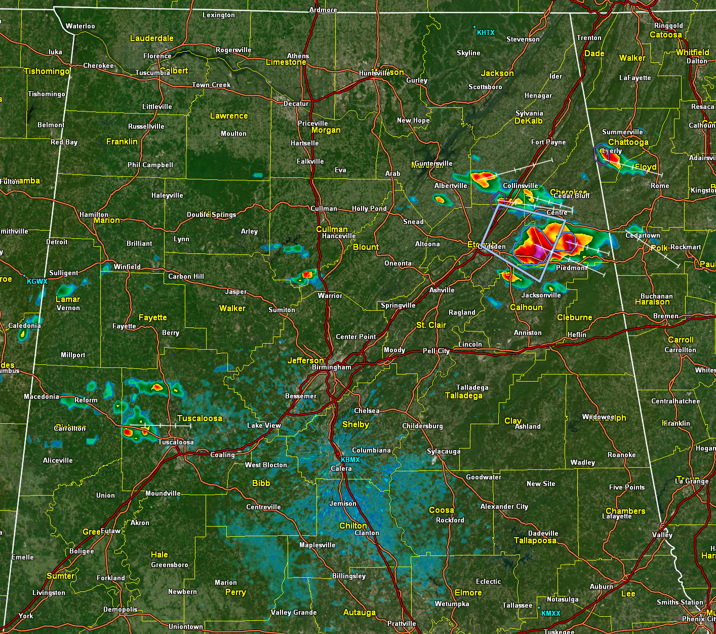
A cluster of strong storms formed this afternoon over northeastern Alabama, including parts of southeastern Marshall, DeKalb, Cherokee, and Etowah, and they are moving into Calhoun and Cleburne counties.
One core is near Ballplay, northeast of Hokes Bluff in northeastern Etowah, and another near Pope and Ellisville in Cherokee County.
According to news media, three-quarter inch hail was reported in Crudup in Etowah County. 1-inch hail is possible. The wet bulb 0C height is conducive for hail. Damaging winds are possible.
Putting down nearly 30 flashes of lightning per minute a little earlier has weakened a bit in the past five minutes.
Damaging wind gusts are possible.
While there is currently no warning, it’s important to note that this is a significant weather advisory, indicating the potential danger of the situation.
A severe thunderstorm watch is not anticipated but loosely organized storms will occur through the rest of the afternoon and early evening across the I-59/I-20 corridor in Alabama.
Category: Alabama's Weather, ALL POSTS, Severe Weather
About the Author (Author Profile)
Bill Murray is the President of The Weather Factory. He is the site's official weather historian and a weekend forecaster. He also anchors the site's severe weather coverage. Bill Murray is the proud holder of National Weather Association Digital Seal #0001 @wxhistorianSubscribe
If you enjoyed this article, subscribe to receive more just like it.


