

Showers Saturday; Much Colder Sunday/Monday
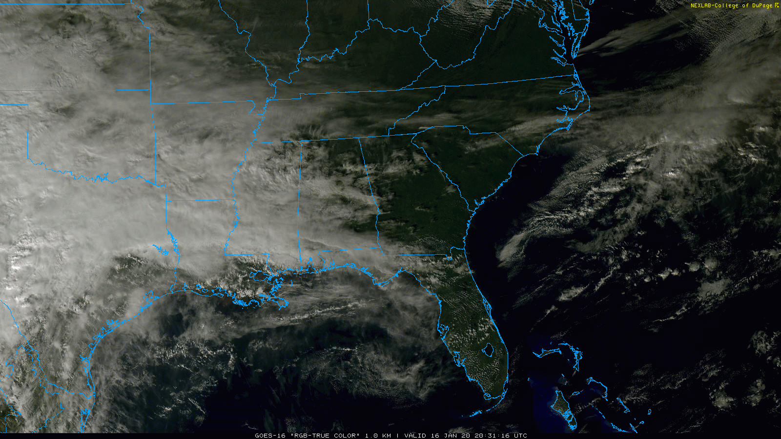
RADAR CHECK: Most of Alabama is dry this afternoon, although we do note some light rain over Pickens and Lamar counties of West Alabama. The sky is partly sunny over the eastern part of the state, and temperatures are between 55 and 62 over North Alabama, with low 70s down to the south. Tonight will be mostly cloudy; temperatures will drop into the upper 30s over the northern counties of the state.
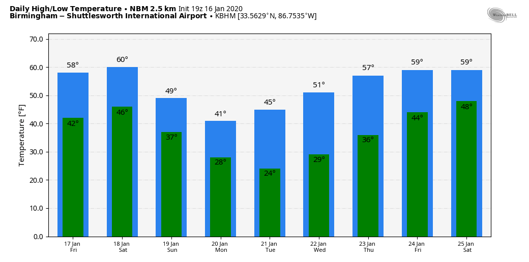
Tomorrow will be mostly cloudy day, but rain should be very hard to find. The high will be in the upper 50s over North Alabama, with 60s to the south.
THE ALABAMA WEEKEND: A cold front will pass through the state Saturday, but this time we have no risk of severe storms. Probably no thunder with a stable airmass in place. Rain amounts should be light; under 1/2 inch. And, it won’t rain all day… looks like the best chance for rain Saturday comes in the window from roughly 11:00 a.m. until 5:00 p.m. The high Saturday will be in the 57-61 degree range before the arrival of the front.
Then, on Sunday, the sky becomes sunny, and the day will be colder with a high in the mid 40s. By Monday morning, we are expecting lows in the low 20s over North/Central Alabama as the coldest air since mid-November arrives.
NEXT WEEK: The weather will be cold and dry Monday through Wednesday. The high Monday will be in the 38-42 degree range, and in the low 40s Tuesday. Still looks like the coldest morning will come early Tuesday; we project temperatures between 17 and 24 degrees. A warming trend begins Wednesday when temperatures reach low 50s. Clouds will increase Thursday, and rain will return to the state at the end of the week on Friday (January 24). The air will be too warm for any snow or ice, and too cold for severe thunderstorms. See the Weather Xtreme video for maps, graphics, and more details.
WET START: Birmingham’s rain total so far this year is 5.94?, which is 3.73? above average. The total since December 1 is 11.03?.
ON THIS DATE IN 2018: A winter storm brought 2 to 4? of snow to parts of North and Central Alabama. The most significant travel impacts were along and either side of the I-85 corridor and along a stretch of I-65 in Chilton and Autauga Counties, where ice-covered roadways resulted in road closures and stuck vehicles and big rigs. Elsewhere, icy roadways were reported as well, though lighter snow totals and blowing of snow from road surfaces helped limit the overall scope of impacts.
BEACH FORECAST: Click here to see the AlabamaWx Beach Forecast Center page.
WEATHER BRAINS: Don’t forget you can listen to our weekly 90 minute show anytime on your favorite podcast app. This is the show all about weather featuring many familiar voices, including our meteorologists here at ABC 33/40.
CONNECT: You can find me on all of the major social networks…
Facebook
Twitter
Instagram
Pinterest
Snapchat: spannwx
I had a great time today visiting with the second graders at Haleyville Elementary… be looking for them on the Pepsi KIDCAM today at 5:00 on ABC 33/40 News! The next Weather Xtreme video will be posted here by 7:00 a.m. tomorrow…
Category: Alabama's Weather, ALL POSTS, Weather Xtreme Videos
About the Author (Author Profile)
James Spann is one of the most recognized and trusted television meteorologists in the industry. He holds the AMS CCM designation and television seals from the AMS and NWA. He is a past winner of the Broadcast Meteorologist of the Year from both professional organizations.Subscribe
If you enjoyed this article, subscribe to receive more just like it.


