Alabama 811 | Know What's Below.

Search Results for 'slidell'

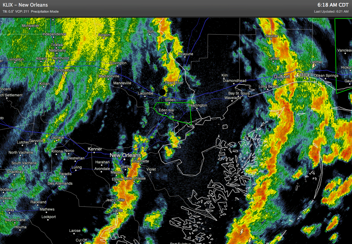
Flash Flood Emergency – Slidell, LA

Flash Flood Emergency – Slidell, LA

| August 30, 2012 @ 5:45 am

BULLETIN – EAS ACTIVATION REQUESTED FLASH FLOOD WARNING NATIONAL WEATHER SERVICE NEW ORLEANS LA 458 AM CDT THU AUG 30 2012 THE NATIONAL WEATHER SERVICE IN NEW ORLEANS HAS ISSUED A * FLASH FLOOD WARNING FOR… SOUTHEASTERN ST. TAMMANY PARISH IN SOUTHEAST LOUISIANA… THIS INCLUDES THE CITY OF SLIDELL…EDEN ISLE… * UNTIL 900 AM CDT […]

Read More

Spot Reports at 4 p.m.: 105 mph gusts at NOS Eugene Island

Spot Reports at 4 p.m.: 105 mph gusts at NOS Eugene Island

| September 11, 2024 @ 4:28 pm

The Naval Ocean Station at Eugene Island on Atchafalaya Bay south of Morgan City is reporting NE winds at 62.1 mph gusting to 105 mph! The pressure was down to 979.8 mb and the water was rising rapidly…now 3.96 feet!

Read More

Isolated Afternoon Storms; Highs Hold In The 90s

Isolated Afternoon Storms; Highs Hold In The 90s

| August 28, 2024 @ 3:09 pm

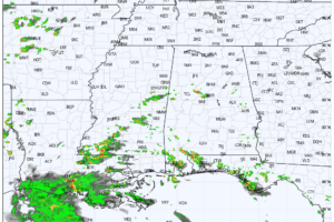
RADAR CHECK: Small, isolated showers and thunderstorms are across Alabama this afternoon, but most of the state is dry with temperatures mostly in the mid to upper 90s. Showers will end this evening; tonight will be fair with a low mostly in the low to mid 70s.

Read More

Hot August Weather Continues With Isolated Afternoon Showers/Storms

Hot August Weather Continues With Isolated Afternoon Showers/Storms

| August 28, 2024 @ 5:40 am

HOT LATE SUMMER WEATHER: Highs will remain in the 90s across Alabama through the rest of the week with partly sunny days and fair nights. Isolated showers and storms are possible over South Alabama this afternoon, and then statewide tomorrow and Friday.

Read More

Spot Reports at 10:30 a.m.

Spot Reports at 10:30 a.m.

| August 29, 2021 @ 10:45 am

Landfall should occur within the hour near Port Fourchon or just west of Grand Isle.

Read More

The April 27th, 2011 Super Outbreak in My Own Words by Chris Darden

The April 27th, 2011 Super Outbreak in My Own Words by Chris Darden

| May 5, 2021 @ 12:00 pm

Chris Darden, the Meteorologist-in-Charge at NWS Birmingham, shares his magnificent story of his experiences leading up to and the several days after the April 27th, 2011 Super Outbreak.

Read More

WeatherBrains 788:  Peaks Of The Week

WeatherBrains 788: Peaks Of The Week

| February 24, 2021 @ 9:00 am

This week’s show was a Monday morning special. The guest WeatherBrain was Ken Graham, Director of the National Hurricane Center! We had a lot to talk about after a record-setting 2020 season!

Read More

Zeta Weakens to a Category 1 Hurricane, Strong Winds & Heavy Rains Lashing Southern Mississippi and Southeastern Louisiana

Zeta Weakens to a Category 1 Hurricane, Strong Winds & Heavy Rains Lashing Southern Mississippi and Southeastern Louisiana

| October 28, 2020 @ 8:09 pm

The National Ocean Service station at Waveland, Mississippi, recently reported sustained winds of 80 mph (129 km/h) and a wind gust of 104 mph (167 km/h).

Read More

Zeta Continues to Batter Southeastern Louisiana & Southern Mississippi

Zeta Continues to Batter Southeastern Louisiana & Southern Mississippi

| October 28, 2020 @ 6:59 pm

Damaging winds, especially in gusts, will spread well inland across portions of southeastern Mississippi, Alabama, and northern Georgia this evening through early Thursday morning, and into the Carolinas and southeastern Virginia on Thursday.

Read More

Hey Nineteen!

Hey Nineteen!

| September 11, 2020 @ 5:12 pm

Tropical depression 19 has formed this afternoon about 80 miles east southeast of Miami. It will move into the Gulf tomorrow and will affect the northern Gulf Coast starting along the Northwest Florida coast late Sunday, and affecting Alabama, Mississippi, and Lousiana through Tuesday or Wednesday.

Read More

Sunday Weather Xtreme:  Tropical Storm Cristobal Will Make Landfall Late This Afternoon in Louisiana

Sunday Weather Xtreme: Tropical Storm Cristobal Will Make Landfall Late This Afternoon in Louisiana

| June 7, 2020 @ 4:49 am

Tropical Storm Cristobal will make landfall on the Louisiana coast south of New Orleans late this afternoon but its effects will be felt well to the east across Mississippi, Alabama, and Florida as well with wind, storm surge, coastal flooding, rip currents, flooding rains, and tornadoes.

Read More

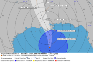
10 p.m. Look at Tropical Storm Cristobal and Its Impacts for the Gulf Coast

10 p.m. Look at Tropical Storm Cristobal and Its Impacts for the Gulf Coast

| June 6, 2020 @ 10:16 pm

Tropical Storm Cristobal is disorganized but impactful as it continues its march toward the Louisiana Coast. It will make landfall Sunday evening south of Houma, Louisiana. Dangerous storm surge will be felt near and well to the east of the center, as well as heavy rain, tropcai storm force winds, and the threat of tornadoes.

Read More

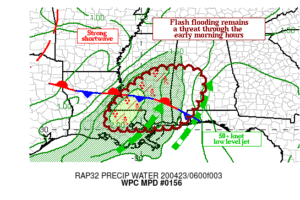
Flash Flooding Threat For The Southwest Parts Of The Area Through The Morning

Flash Flooding Threat For The Southwest Parts Of The Area Through The Morning

| April 23, 2020 @ 3:24 am

A quasi-linear line of intense thunderstorms with torrential downpours will slowly track eastward through the early morning hours. Periods of training may result in hourly rainfall rates approaching 3 inches per hour and will likely lead to additional instances of flooding.

Read More

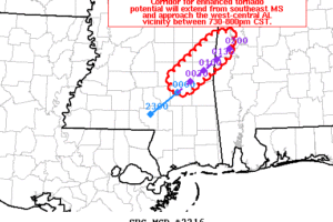
Localized Mesoscale Discussion Focusing On The Southwestern Parts Of The Area

Localized Mesoscale Discussion Focusing On The Southwestern Parts Of The Area

| December 16, 2019 @ 6:19 pm

A corridor for enhanced tornado potential will extend in the near term across southeast MS with a discrete supercell. The risk may continue into far west-central AL between 730-800pm CST.

Read More